
The United States has more protected wilderness than almost anywhere on earth. The national park system covers over 84 million acres, the trail network runs to hundreds of thousands of kilometres, and the range of terrain, from sea-level rainforest in Olympic to high desert in Joshua Tree to glacier country in Glacier, is extraordinary. The National Park Service recorded 331.9 million recreation visits in 2024, an increase of more than 6 million visits from 2023, with 28 parks setting new individual visitation records that year. The challenge isn't finding good places to go. It's navigating a permit system that has become increasingly competitive as visitor numbers have grown. Here's a practical guide to the best of it.
Yosemite: Worth the Crowds If You Plan Right
Yosemite Valley is one of the most photographed places in the world and one of the most visited national parks in the US. The valley itself, 11km long and 1.6km wide, is surrounded by walls of granite rising 900 metres. El Capitan, Half Dome, and Bridalveil Fall are the iconic sights, and they genuinely are as impressive in person as the photos suggest.
The problem is that 4-5 million people visit per year, mostly concentrated in the valley. The solution is to avoid it or work around it. The high country, accessible via Tioga Road (open late May to November depending on snowpack), offers a completely different experience. Tuolumne Meadows at 2,621 metres is the starting point for dozens of backcountry routes with a fraction of the valley's traffic. The John Muir Trail northbound start is here.
Day permits are required for Half Dome cables (the final 120-metre section to the summit) from late May through mid-October. The lottery opens in March for that season. Apply early. The cables are genuinely exposed and require comfort with heights; people turn back frequently. The hike without the cables, to the base of the dome, is still a full day (22km, 1,500m gain) and worth doing independently.
Accommodation inside the park books out 12 months in advance. The Curry Village tent cabins and valley campgrounds are the most accessible options. For more flexibility, stay in Groveland or El Portal outside the park and drive in before the day-use permit window opens.
Zion: Slot Canyons and the Narrows
Zion National Park in Utah is built around a single canyon carved by the Virgin River through 300-metre sandstone walls. The colours here, cream, orange, and deep red layered over millennia, are different from anything in the Rocky Mountain parks. The park is compact, accessible, and offers some of the most distinctive hiking in the US. In 2024 Zion recorded 4.9 million visits, making it the second most visited national park in the country behind Great Smoky Mountains, according to Smithsonian Magazine's analysis of NPS data.

The Narrows is Zion's signature experience: a hike up the Virgin River through a slot canyon as narrow as 6 metres and up to 300 metres deep. You walk in the river for most of it, knee to waist deep depending on water levels. The full Narrows is 26km top-to-bottom with a permit and shuttle; the bottom-up version requires no permit and covers the most dramatic section in 6-8 hours. Neoprene socks and a walking stick (rentable in the park) make a real difference. Water temperatures can be very cold even in summer.
Angels Landing is Zion's most famous hike: a 2.7km trail that ends on a narrow sandstone fin with chain-assisted scrambling on the final section. A permit is now required (lottery-based, drawn the week before your visit via recreation.gov). The views from the top are exceptional, but the exposure is significant. The route to Scout Lookout below the chains gives a similar view with less technical commitment.
Zion is in the southwest desert, which means summer temperatures regularly exceed 40°C in the canyon. May, early June, September, and October are far more comfortable. The Life on the Edge T-Shirt, made from heavyweight garment-dyed cotton, breathes well in dry heat and holds up to the abrasive sandstone walls you'll brush against in the Narrows. Pack it alongside the Raised on Peaks T-Shirt for evening camp wear.
Grand Canyon: Going Below the Rim
The Grand Canyon receives 6 million visitors per year, the vast majority of whom look over the edge and leave. Going below the rim changes the experience entirely. The inner canyon is 600 metres deeper, a full temperature zone warmer, and almost entirely different terrain from the rim. The Colorado River at the bottom is 1,600 metres below the South Rim.
The Bright Angel Trail (13km, 1,300m descent) is the most reliable route down from the South Rim, with water stations and shade at Indian Garden (now Havasupai Gardens) at the 7.5km mark. Going rim-to-river and back in a day is officially discouraged and frequently causes heat casualties in summer. A two-day trip with a night at Bright Angel Campground at the river is far safer and more enjoyable.
Phantom Ranch, the only lodging below the rim, requires reservations through a lottery that opens 15 months in advance. Backcountry permits for camping at the river are also in high demand. Apply through the backcountry permit system at the National Park Service website. Alternatively, consider the North Rim (open mid-May to mid-October), which receives only about 10% of South Rim visitor numbers and has trails with much more solitude.
The canyon is always 5-10°C warmer than the rim. Bring more water than you think you need (minimum 4 litres for a full day below the rim in summer) and start very early to descend in cooler temperatures. The Embrace The Mountain Call Tee is a good choice for canyon days, lightweight cotton that handles dry heat well and dries quickly if you get wet at the river.
Glacier National Park: Going-to-the-Sun Road
Glacier in Montana is less visited than Yosemite or Zion and genuinely worth the extra travel to reach it. The Going-to-the-Sun Road, a 80km mountain highway completed in 1933, crosses the Continental Divide at Logan Pass (2,026m) and is one of the most dramatic roads in North America. Private vehicles require a timed entry permit from late May through early September, bookable on recreation.gov.
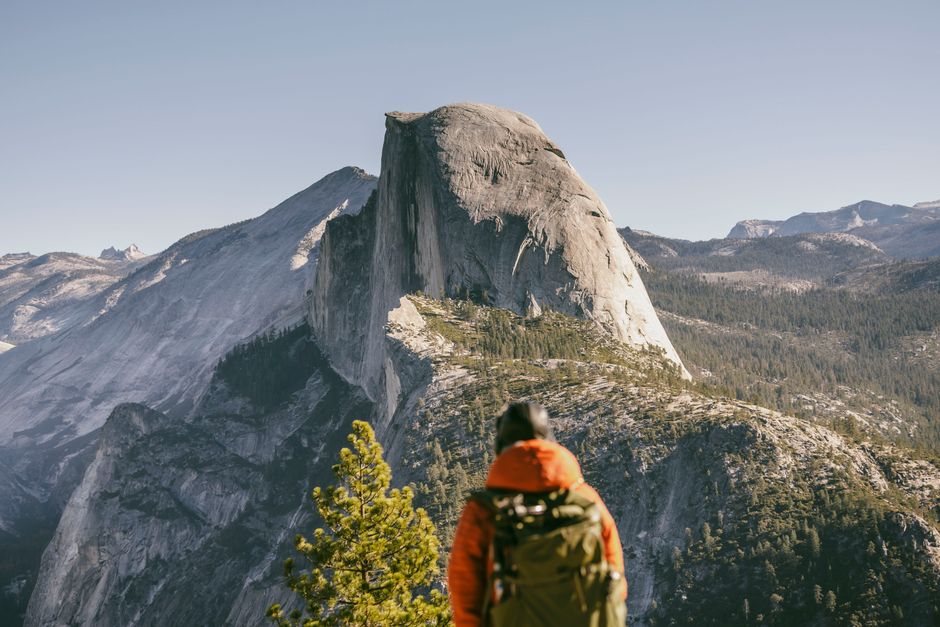
Photo by Stephen Leonardi via Pexels
The Highline Trail from Logan Pass is the park's best day hike: 19km along a ledge cut directly into the Garden Wall, a 300-metre cliff above the valley floor, with views of glaciers, mountain goats, and the mountain peaks on both sides of the divide. The trail is exposed on the initial section (a fixed rope is provided for the first 50 metres) but not technically difficult beyond that. Allow 6-7 hours one-way; a shuttle bus returns from the Granite Park Chalet at the trail's end.
Grizzly bears are present throughout the park and active. The standard protocol is to hike in groups of three or more, carry bear spray accessible on your hip (not in your pack), make noise on blind corners, and store food in bear canisters or hang it overnight. The bears are not aggressive toward groups making normal noise; most sightings are of bears moving away from people. Glacier has one of the healthiest grizzly populations in the lower 48 states and it's worth keeping it that way.
The park's glaciers, which gave it its name, are retreating rapidly. Of the 150 glaciers present in 1850, around 26 remain today. The hiking is still exceptional and the ice still visible on north-facing slopes, but the timeline for seeing the last remaining named glaciers is uncertain. The shoulder seasons (late September for autumn colours and minimal crowds) are worth considering if your schedule allows.
Olympic National Park: Rainforest, Coast, and Alpine
Olympic in Washington state is one of the most ecologically diverse national parks in the system. The Hoh Rainforest on the western slope receives 3-4 metres of rain annually and contains old-growth temperate rainforest with bigleaf maples draped in moss and Sitka spruce trees over 60 metres tall. The Hall of Mosses trail is a 1.3km loop through the densest section and is among the most visually striking short walks in any US national park.
The Pacific coast sections, particularly Rialto Beach and Cape Flattery, are rugged and genuinely wild. Sea stacks, tidepools, and driftwood beaches stretch for miles without development. The backcountry coast trail between Rialto and Cape Alava (35km) requires tide tables to navigate headlands and is a genuine wilderness experience within a few hours of Seattle.
The Hurricane Ridge area in the park's northern alpine zone offers sub-alpine meadows and views across the Strait of Juan de Fuca to Canada. The road to Hurricane Ridge is paved and accessible in summer without hiking; the surrounding trail network extends into several days of backcountry travel. Permits are required for backcountry camping and are increasingly competitive.
Long Trails: JMT, PCT, and Appalachian
The three great long trails of the USA each offer a different experience. The John Muir Trail (JMT) covers 340km from Yosemite Valley to Mount Whitney through the Sierra Nevada, spending almost its entire length above 2,400 metres. Permit quotas are strictly enforced and highly competitive: 60 percent of daily quota spots are released six months in advance on recreation.gov, with the remaining 40 percent becoming available two weeks before your entry date, according to Inyo National Forest. The Trail Crest exit quota on Mt. Whitney is capped at just 25 people per day. Apply in the February lottery for a Yosemite start or enter a daily lottery for cancellations. Budget 3-4 weeks and plan food resupply drops to post offices at Tuolumne Meadows, Red's Meadow, and Muir Trail Ranch.
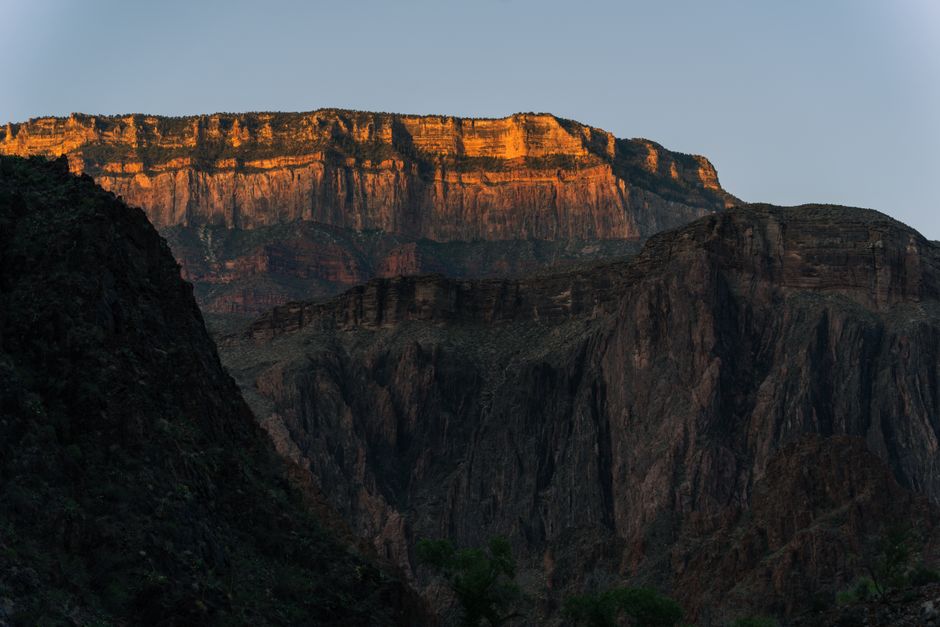
Photo by Alex Moliski via Pexels
The Pacific Crest Trail (PCT) runs 4,265km from the Mexican border to Canada through California, Oregon, and Washington. Thru-hiking takes 4-6 months. Section hiking is more practical for most people: the Sierra High Route through Kings Canyon (California), the Crater Lake section in Oregon, and the North Cascades section in Washington are among the best stretches. A PCT permit is required for thru-hikers; section hikers need wilderness permits for specific areas along the route.
The Appalachian Trail (AT) is 3,510km from Springer Mountain, Georgia to Mount Katahdin, Maine. The culture around the AT is different from western trails: more shelter-based (lean-tos every 15-20km), a longer history of thru-hiker community (trail names, trail magic, hostel culture), and a more social experience overall. Over 4,000 people attempt the thru-hike annually, but the Appalachian Trail Conservancy estimates only around 25 percent complete it. The 20,000th recorded thru-hike completion was reported in 2018, just ten years after the 10,000th, reflecting how sharply interest has accelerated. Start at Springer in late March to April for the northbound thru-hike to avoid the summer heat in the south and to reach Katahdin before its late October closure.
For any of these long trails, the Peak Junkie Hoodie is a solid camp-layer choice, the 9oz premium fleece handles evening temperatures from the Sierra to the White Mountains, and the full Origin Collection covers the range of outdoor-focused designs. The outdoor T-shirt collection is the right starting point for trail tees that work as hard as you do.
Permit Systems: How to Navigate Them
The US national park permit system has become significantly more complicated over the past decade. Most major parks and trail segments now use recreation.gov for advance reservations. Key rules: create your recreation.gov account before you need it, set up notifications for specific permits, and check for rolling release windows (some permits release 6 months in advance, others 1 month, others 24 hours before).
For popular day hikes (Half Dome cables, Angels Landing, Enchantments), set calendar reminders for the lottery application window. Missing the first lottery doesn't end your chances: most systems have a rolling cancellation release that rewards checking frequently. Shoulder season visits (May-June and September-October) have dramatically less competition for permits across all parks.
State parks often provide similar terrain to national parks with no permit requirements. In California, the state park system includes coastal redwoods, desert canyons, and alpine lakes that rival the national parks in quality without the reservation pressure. Worth researching for any region you're visiting.
FAQ
- When should I visit national parks to avoid the biggest crowds?
- Shoulder seasons are the best answer: May to early June and September to October. These months offer good weather in most parks, fewer visitors, and better permit availability. Specific exceptions: Glacier is best in late July through August for accessible high country; the Appalachian Trail is best in autumn for foliage in the northeast.
- How much does a national parks trip cost?
- The America the Beautiful Annual Pass ($80) covers entrance to all national parks for 12 months and pays for itself after 3-4 visits. Backcountry permits typically cost $5-15 per person per night. Camping inside parks ranges from $20-35 per night. Budget accommodation in gateway towns varies widely but camping outside parks in national forests is often free.
- Do I need bear canisters for national park camping?
- Requirements vary by park and area. In Yosemite's backcountry and most Sierra Nevada wilderness, bear canisters are mandatory. In Glacier and the North Cascades, approved canisters or hanging from a tree is required. Check the specific park's backcountry regulations before your trip. Canisters are rentable at most park visitor centres.
- What fitness level do I need for the JMT?
- The JMT requires solid multi-day hiking fitness. The altitude (most of the trail above 3,000m) is the main challenge for people not acclimatised. If you're based at sea level, spending 2-3 days at altitude before starting reduces the impact. Training with a loaded pack on hilly terrain for 2-3 months before departure is the standard recommendation.
- Can I hike in national parks without advance permits?
- Many day hikes in national parks require no permit at all. The permit system primarily applies to backcountry overnight camping and a handful of high-demand day hikes (Half Dome, Angels Landing). Check the specific park's website for current requirements. National forests adjacent to parks are often permit-free and offer comparable scenery.
Related Reading
Frequently Asked Questions
How many acres does the US national park system cover?
The US national park system covers over 84 million acres, making it one of the largest protected wilderness networks on earth. The parks span an extraordinary range of terrain, from sea-level rainforest in Olympic National Park to high desert in Joshua Tree to glacier country in Glacier National Park.
How many people visit US national parks each year?
The National Park Service recorded 331.9 million recreation visits in 2024, an increase of more than 6 million visits compared to 2023. That year, 28 individual parks set new visitation records, reflecting continued and growing demand for access to the national park system.
What are some of the most diverse national parks in the USA?
The range of terrain across US national parks is genuinely extraordinary. Olympic National Park in Washington has temperate rainforest at sea level, Joshua Tree in California offers high desert rock climbing and night skies, and Glacier National Park in Montana has glaciated peaks and backcountry routes through some of the most remote terrain in the lower 48 states.
How extensive is the trail network in the USA?
The US trail network runs to hundreds of thousands of kilometres, including iconic long-distance routes like the Appalachian Trail, the Pacific Crest Trail, and the Continental Divide Trail. These connect into a far broader system of national forest, wilderness area, and park trails spread across every region of the country.
Which US national parks set new visitation records in 2024?
In 2024, 28 national parks set new individual visitation records, according to the National Park Service. The overall system recorded 331.9 million recreation visits for the year, continuing a trend of rising visitor numbers across the park network.
Explore the Captain Puffin collection
Last updated: April 2026


